Trip Report
Carroll Cave Neckbreaker Mop-Up Survey Trip
Trip Date: Oct 29 2022My first time leading a survey trip as a sketcher. Surveying leads in the eastern end of one of Missouri’s longest caves. We also explore one of the most decorated side passages in the cave to see the famous “Azure Pool”.
In May of 2022, a couple months before we moved to Kansas City, I responded to an email from Bill Gee who was seeking personnel for a couple science trips into Carroll Cave. Looking for any opportunities to get involved with caving in Missouri, I signed up for the “longer and more difficult” bat census trip scheduled for October 29th.
On 8/27/22, shortly after our belongings finally arrived in our new home, I attended a big survey trip into Carroll Cave organized by Dan Lamping. I was assigned to a team targeting leads in the Mountain Room, which was exactly where Bill’s October trip would be visiting. After our 12-hour trip downstream in the Carroll River, there were still a few leads left to be surveyed near the permanently closed historic entrance. I decided I’d offer up my spot on Bill’s trip to someone else who had not had the opportunity to visit the Mountain Room and instead set up my own trip to try to knock off the rest of the leads in that area. I was able to recruit Kristen Vogel and John Nigro of the Kansas City Area Grotto to help out with the survey, at least partially due to enticing them with a side trip to a very well decorated passage along the way.
I arrived on site just before 8am and set up my car for camping. I talked with Bill Gee and Martin Carmichael about the work completed yesterday both above ground on the shelter house and below ground in collecting some samples in the mined entrance shaft. John and Kristen rolled in at 8:45 and by the time they were ready to enter the cave, Bill’s team was also. Bill was giving some instruction to some of the newer cavers inside of the silo when I got on rope at 9:30 and rappelled in.
My first objective was to recalibrate the KCAG disto. I have been advised that it is always a good idea to recalibrate any time you are surveying in a new area, and the disto had been calibrated the previous weekend in a cave back in Tennessee. Bill’s team still hadn’t arrived when the calibration was finished at 10am and we headed further into the cave. It took us 1 hour to reach the lunch room where a break was needed.
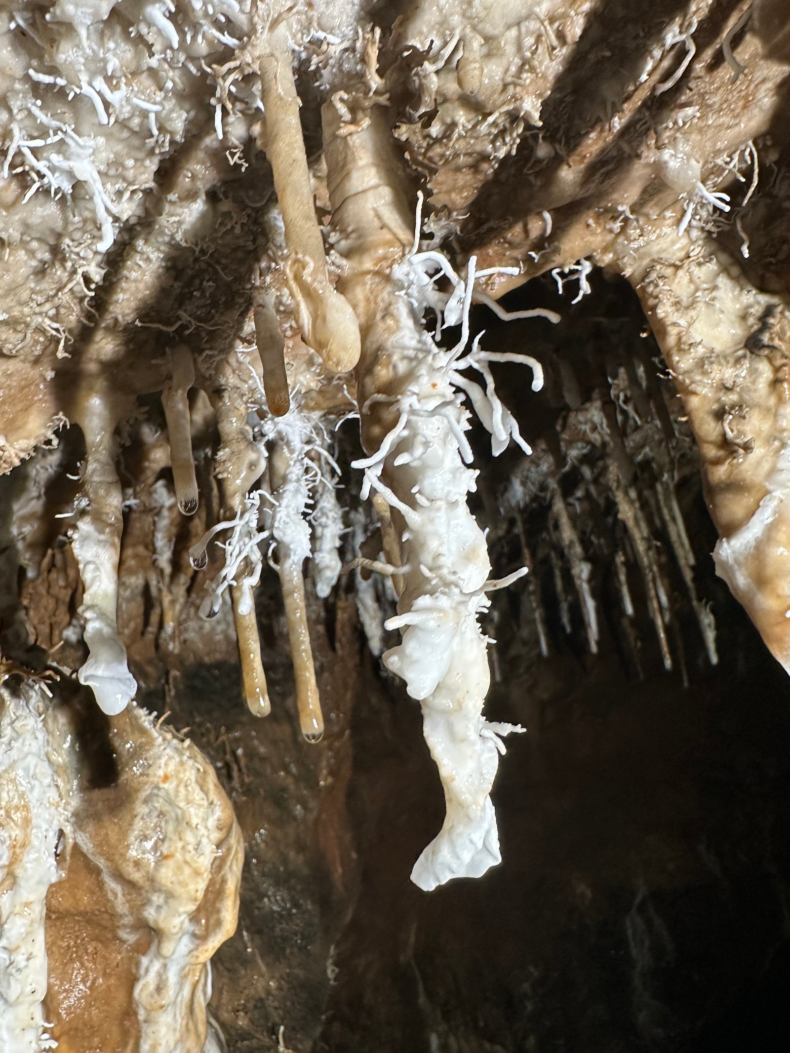
Not knowing how muddy we would be getting in the survey part of the trip, the group decided it would be better to tour the side passage while we were still clean. The “Paradise Passage” is a significant infeeder to the Carroll River and contains one of the most decorated areas of the cave. I have talked with a few people and gotten a sense that visiting this area is somewhat controversial. Carroll is a very muddy cave, and each new visitor is bound to track in some more mud. I initially planned to bring some big black trashbags to strap around our boots but was told by multiple people that it would not be effective. Rick Hines just emphasized to use common sense and not to go near the areas around the pristine pool that could be further stained with mud.
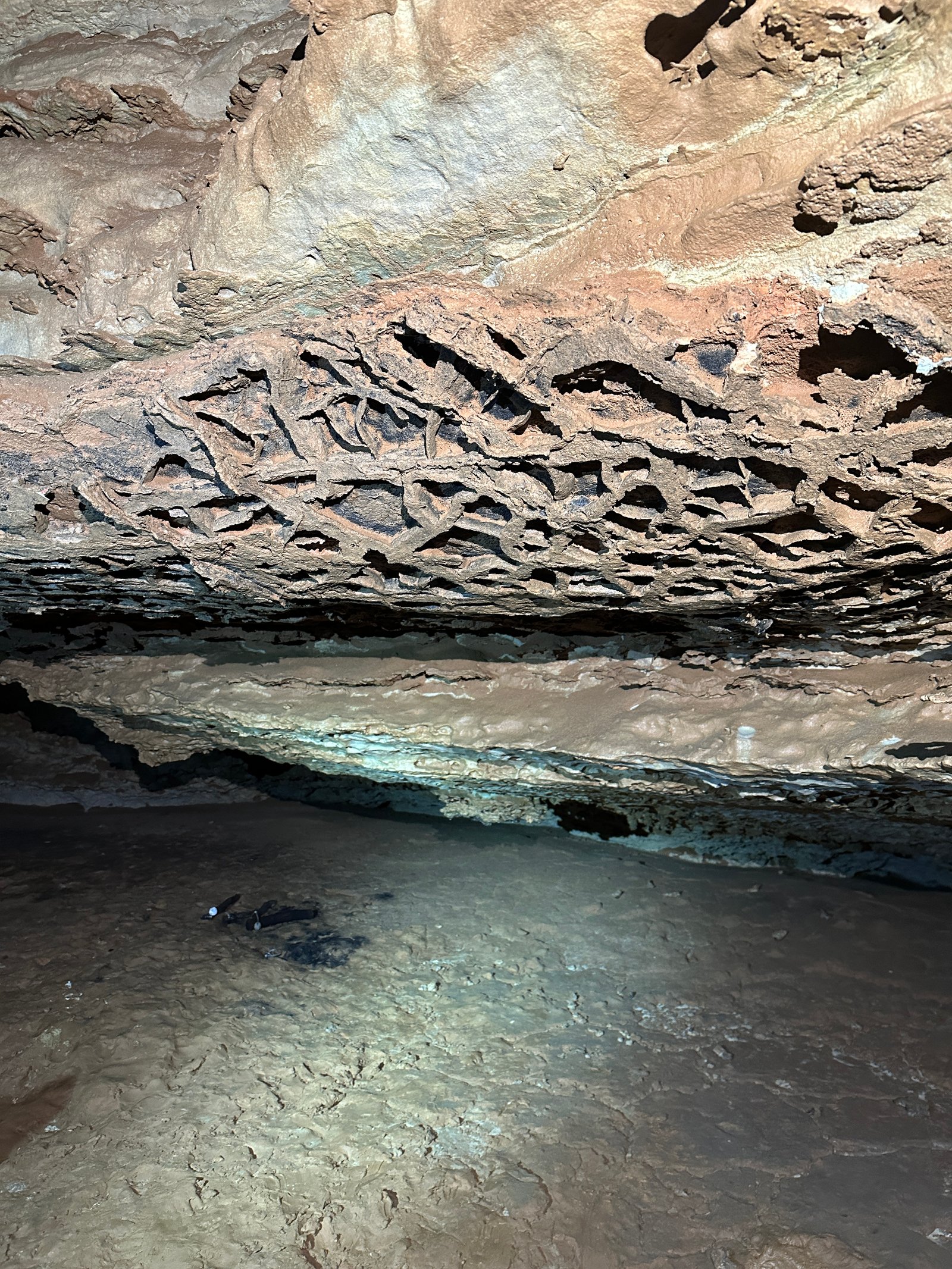
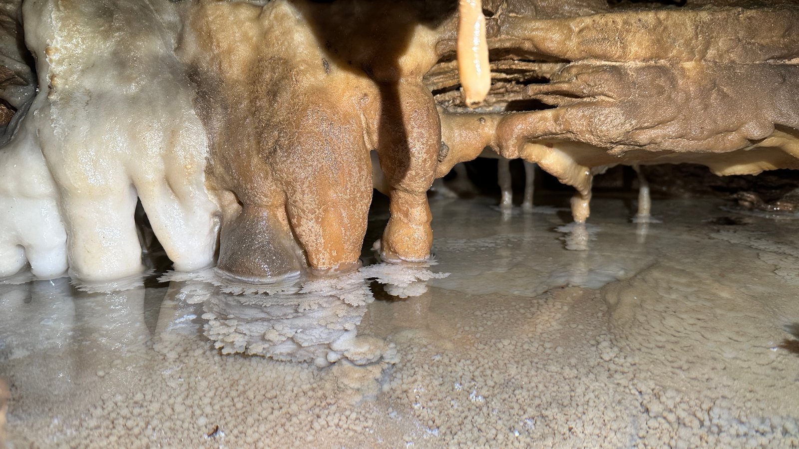
We arrived at the first dry cut-around out of the river around 11:30am that is reached just before the actual start of the side passage. There was a nice drippy pool with white calcite formations around it and a full wall of white flowstone. We reached a short climbdown that drops down into the water feeding into the Carroll River from the Paradise Passage. From here, the comfortable walking passage is generally less muddy. The walls were intermittently lined with thin hairy helectites, both white and brown. Many of the small stalactites and soda straws also had these helectites growing off of them as well. I noted an area along the left wall covered in animal (bear?) claw marks and also a large hanging formation with scalloping along its surface which was unique. There was one pool with a giant white flowstone wall perched above it that definitely seemed like it had seen some cleaner days. If I am remembering correctly, this area is where there was a constriction that one had to climb through to proceed down the passage.
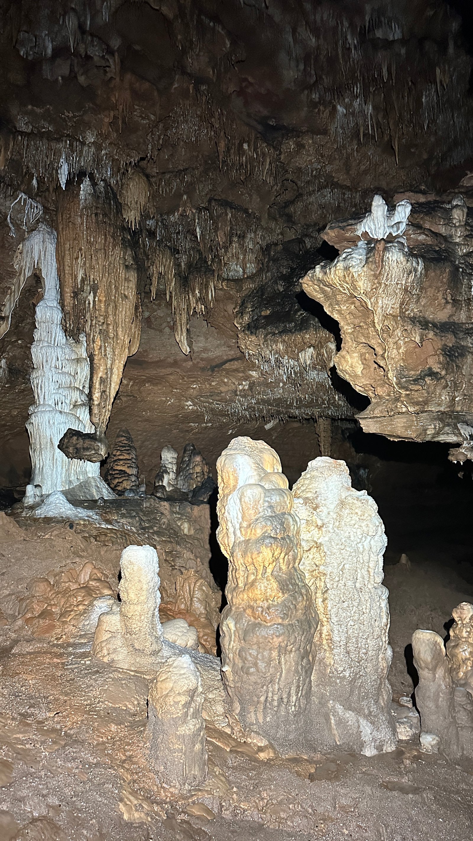
The passage just beyond this constriction was a comparatively plain borehole. The mud was dry and compact, and the water meandered along the way. I thought I even saw sand in some areas, but it was just *less wet* mud. Eventually I spotted a nice formation area down a short climbdown along the right wall. The coolest part were the pools which had white and brown flowstone dropping down into the water which radically transformed into some type of subaqueous formation just below the water level. The white rimstone dams here still seemed fairly pristine.
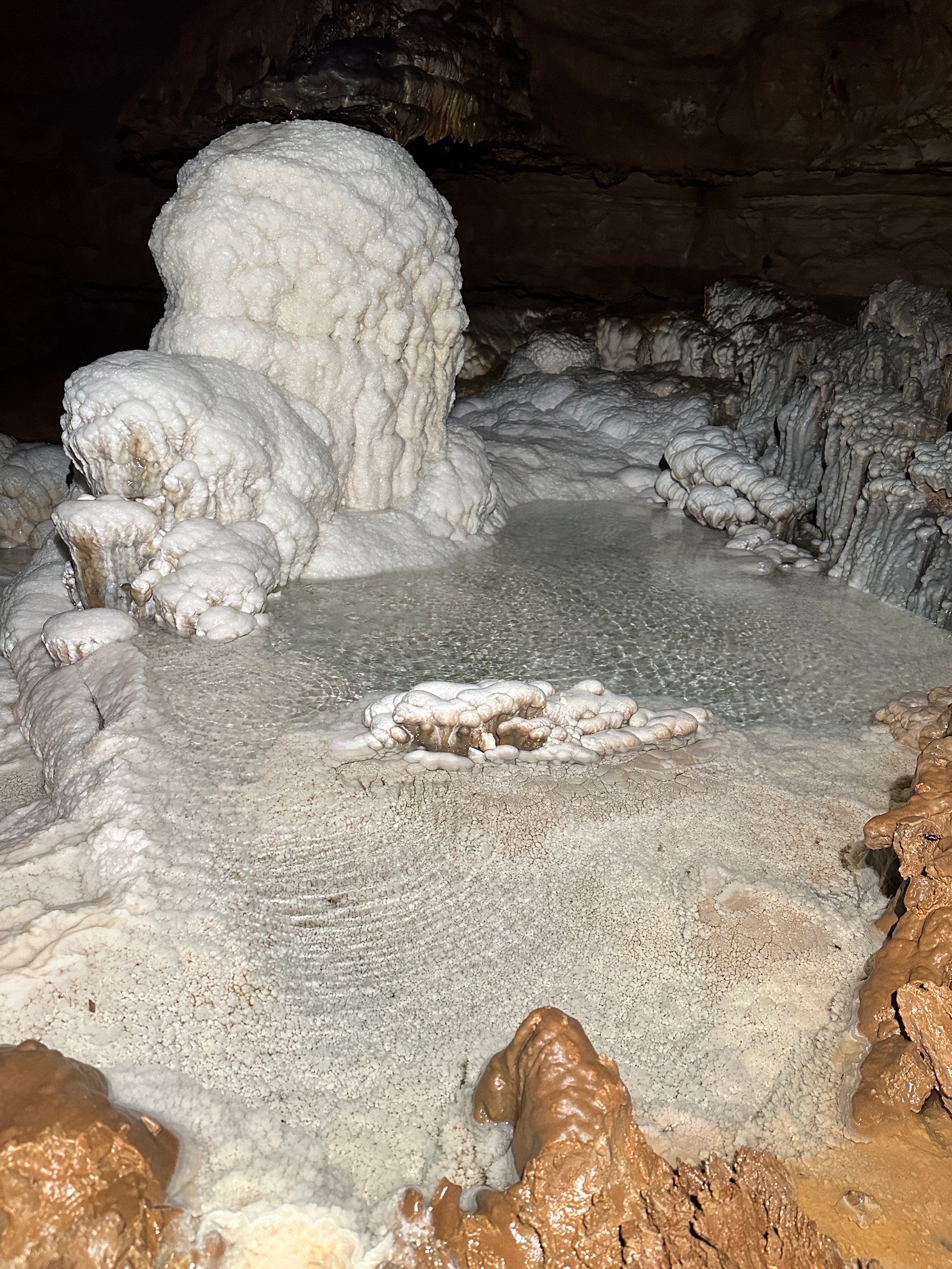
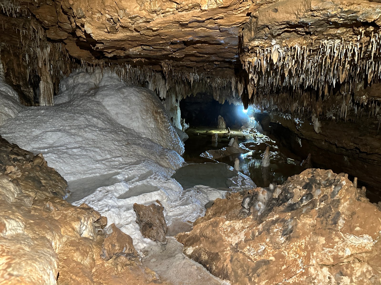
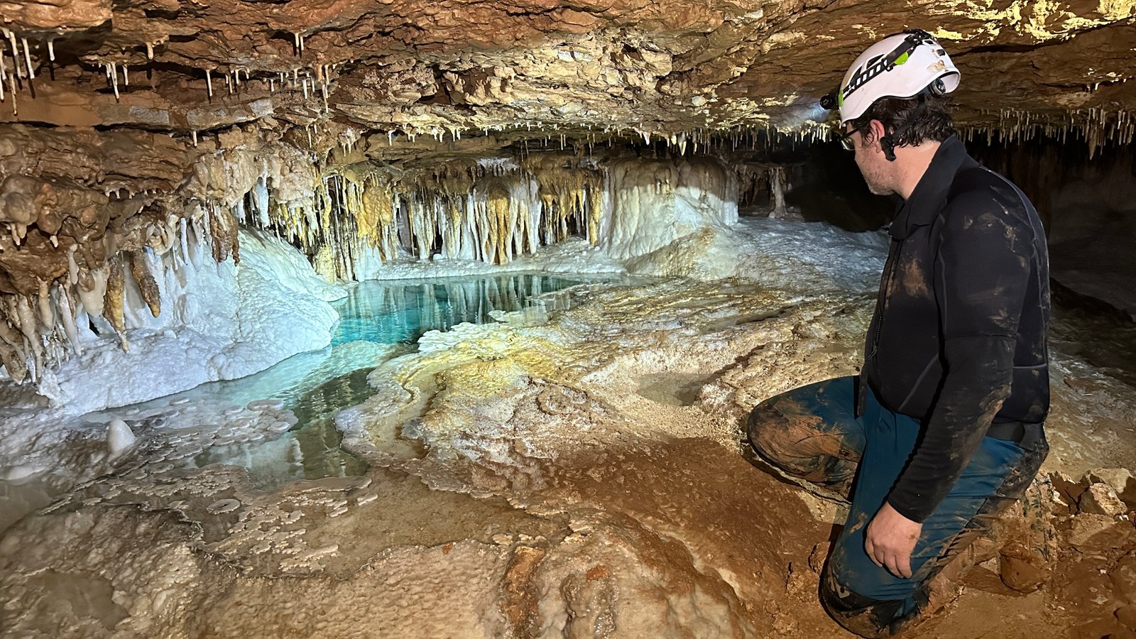
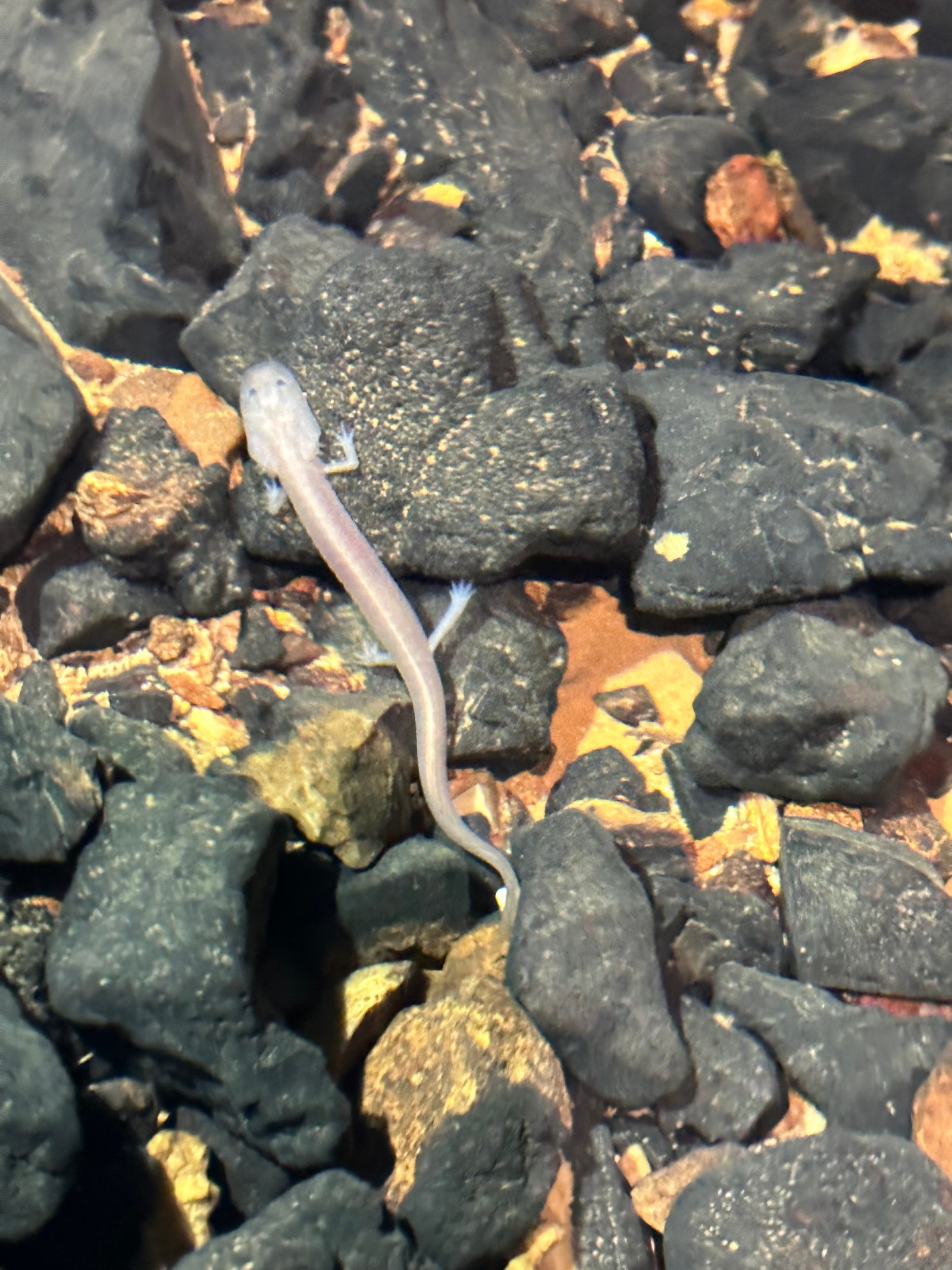
The next obstacle is the only one that requires a bit of core strength to cross through without causing any damage to the cave. A hands and knees crawl along the left wall balancing on muddied stalagmite nubs while both avoiding the huge pool of water on your right and the soda straws above your head. One must move slowly and cautiously. On the other side, one is rewarded with the famous “Azure Pool”, a deep blue pool surrounded by white rimstone dams which have been unfortunately trampled with mud over the years. A significant rock wall has been built up around it to dissuade cavers from climbing up to the rim of the pool as surely countless others have done over the decades for a close-up photo. I would love to see some early photos of the area. We took turns getting some photos of each other at a safe distance from the pool around 12:30pm then headed back toward the Carroll River. We spotted a grotto salamander in the stream along the way.
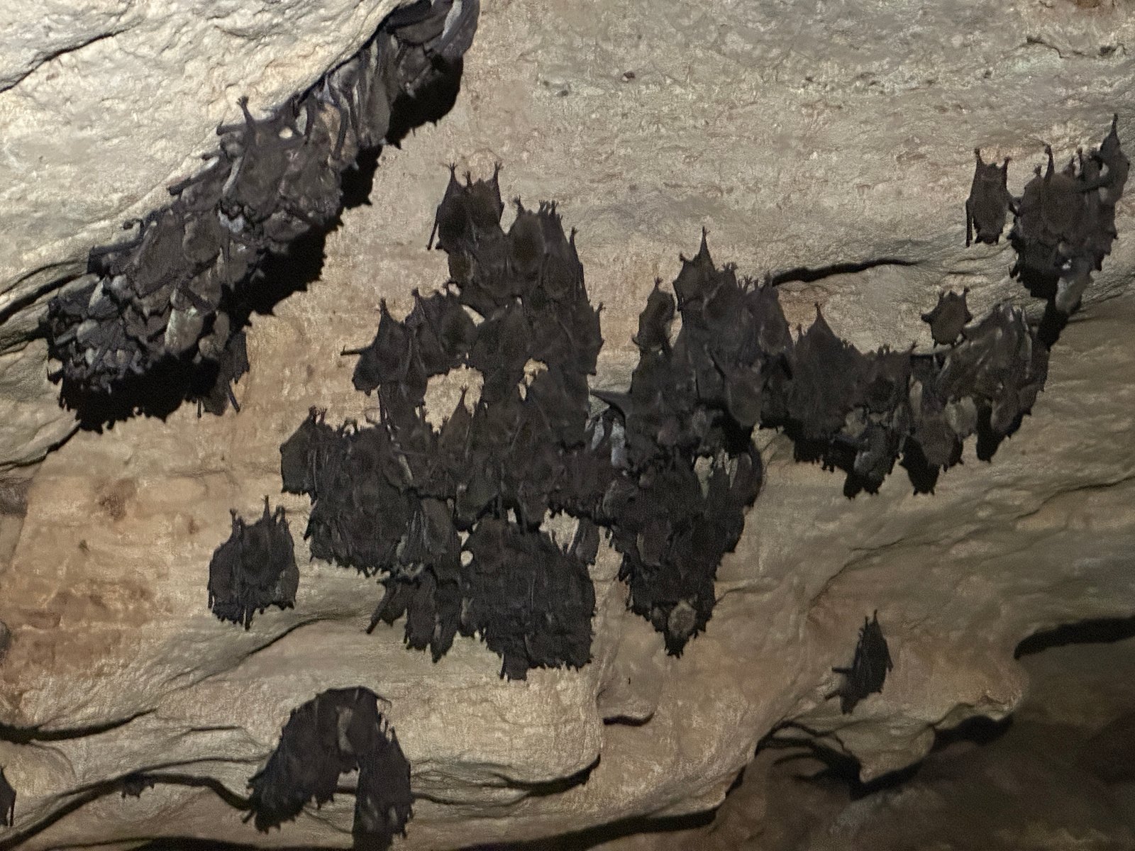
I was eager to pick up the pace toward the Mountain Room at that point. Coincidentally, Bill’s group reached the intersection of the Paradise Passage along the Carroll River exactly as we arrived. So far they had counted zero bats, but I let them know we had seen one flyer earlier. We also discussed some exit/callout specifics that we probably should have communicated beforehand, then continued downstream. I hoped for a strong and steady pace downstream, but the mud was starting to slow down the team, and John was having some headlamp issues. We didn’t seem to ever fully be able to break away from Bill’s team for a significant period of time despite Bill leading the team along with a relatively slow pace in order to carefully check for bats. Bill caught up with us again near a snake skeleton which I somehow did not see during my first trip. We did not reach the end of the mountain room until 3:30pm.
From here, we shed some of our extra gear and assigned survey roles. John would be on point, Kristen on distox, and I would be sketching digitally with topodroid (a survey app which connects wirelessly to the distox via bluetooth) on my samsung note. I have sketched only a handful of times, and always under the supervision of someone much more experienced than me. This would be my first time leading a survey trip as the sketcher, and also my first time using topodroid in a cave. I previously sketched with an app called “qave” which is more simple and intuitive than topodroid, but apparently has a number of quirks when it comes to exporting data. Topodroid is a more robust and customizable app with a steeper learning curve and is currently the “industry standard” when it comes to digital cave survey. I regret not taking more opportunities to sketch when I lived closer to caves in Tennessee, and was eager to get some experience under my belt to show some of my new friends in the Missouri caving community how streamlined the process can be.
We worked our way into the water beyond the Mountain Room around 4pm, stepping further into the cave than I had ever been. It was definitely the deepest water we had encountered, though I was still able to stand on my tippie-toes and keep *most* of my torso dry. John and Kristen brought lifejackets with them that up until this point hadn’t provided much support other than an extra layer of warmth, but reported some assisted floating in this area. I was wearing neoprene pants and socks and had a neoprene vest, but stepping into the deep cold water I began to wonder if I should have brought a full wetsuit. But once the initial shock was over, my body temperature evened out. I was able to walk hunched over through the “neck breaker” and still manage to keep my upper torso dry, though it was much lower air space than I had anticipated.
Once we passed through the neckbreaker, I quickly identified the last survey station left by Dan Lamping and Ben Geisert back in August. We were targeting some leads along the opposite/north wall and began a JKC survey. The first lead only took a single shot and ended immediately. The second lead was up a short climb 4’ above the water and looked pretty decent. I spent some time directing Kristen at shooting splays all around and was nerding out in excitement as everything immediately showed up on the screen of my sketch. I took my time and even went back into the passages to see if there were any other details I could add in. We surveyed a muddy passage and passed a small guano pile. We could hear some screeching off in the distance as well. We surveyed past a low belly crawl in water on the right and dreaded having to survey through there (it actually just popped right back into the Carroll River so we didn’t have to). As we rounded a corner, there was a natural bridge supporting an upper level. John went ahead into the lower level in the water and noted that there was a cluster of bats. I went back to get my phone to make sure to get some photos for Bill and we did our best to try to stay quiet around them.
At some point, John was getting cold so he and Kristen swam back to the Mountain Room to get some extra layers leaving me to do some surveying on my own. I spent some time surveying the short upper level which forked into two drops down into the river passage below where all the bats were roosting. Then I was able to climb back down and quietly set one more station on the far wall that would allow for one long shot directly through the bat area back toward our tie-in. I was also able to splay into that low wet belly crawl near JKC3 we had passed earlier so that surveying through it would not be necessary. It’s a pretty cool feeling to use the disto and be in control of the splay shots that you need to create an accurate representation of what you’re seeing around you on the screen. I was able to get all the wall details I needed with minimal disturbance to the bats.
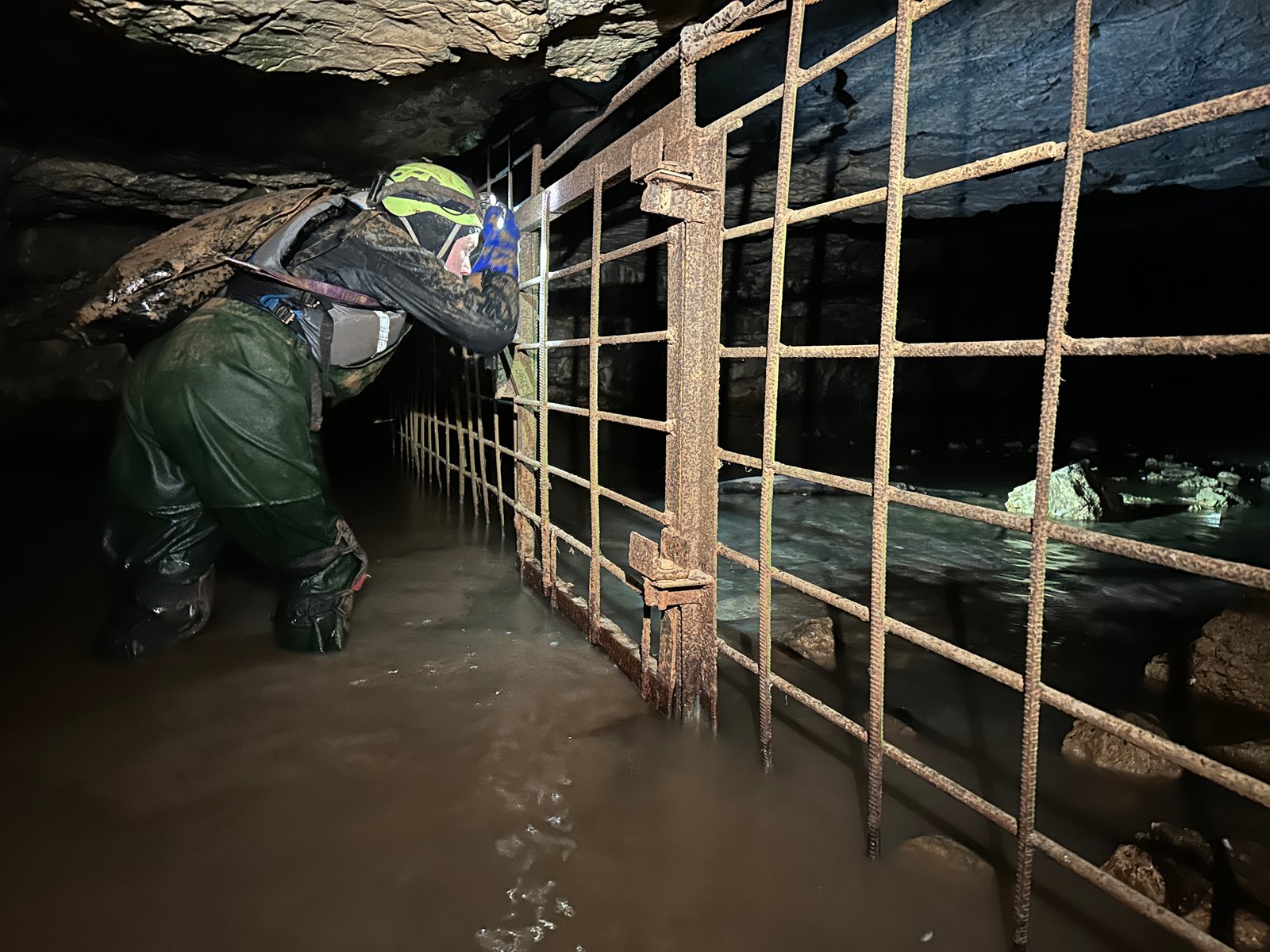
Kristen and John arrived back and we decided to take a quick tour of the downstream end of Carroll river to see the historic entrance. We weren’t sure whether or not we’d catch the sunset from behind bars. Before I realized we were approaching the gate, I saw and heard a car drive by which was a very strange experience. There was no sunlight left, but when we turned off our headlamps we could still see the twilight in the eastern sky. The gate did not look like it was breachable.
We headed back to our survey and carefully set up a 104’ shot across the bat area. We weren’t able to directly hit the tie-in at A10, but closed the loop with one final station. We surveyed one final muddy crawlway off of JKC3 before finishing up for the day. We arrived back at the Mountain Room where the rest of our gear was stashed at 8:30pm.
The trek back was slow. John was fighting a continuous battle with the mud and the mud seemed to be winning. I led the march ahead and mostly stayed within eyesight except in the extremely muddy turnpike shortcut, where halfway through I decided to run ahead and wait at the end of it in the lunchroom. I was able to cleanwash all of my gear by the time the group was reunited. We didn’t reach the entrance shaft at 12:30am. I climbed out and got changed. When Kristen and John surfaced, I helped pull up the rope which was our signal to Bill that we had made it out safely. Everyone in camp was fast asleep.
The total surveyed distance was 406’, but only about half of that was new survey. There is still one decent looking lead closer to the historic entrance along the north wall, and one or two small holes up high on the south wall that need to be surveyed. Overall it was a great confidence booster to finally get a sketching trip under my belt with topodroid. Looking forward to more sketching opportunities soon.
Click here to view my entire archive of trip reports & caving articles